The data
Southern Farming System's (SFS) soil moisture network across Victoria and Tasmania was stored in a closed database. The dataset was difficult to discover, and the access conditions were not clearly specified to potential users of the data. Each individual request for data needed to be executed by research or technical staff, which was a poor use of time.
The challenge
The challenge was to make the data discoverable and accessible for research, but only under conditions specified by the data provider to protect the rights of the data owners.
SFS was interested in providing data to researchers for predictive modelling of soil moisture.
The solution
The Centre for eResearch (CeRDI) at Federation University assisted SFS to make data more discoverable and accessible for research.
- Data was delivered via and OGC-compliant SensorThings API
- The data was described using machine readable controlled vocabulary terms
- Data was made available by an authentication system (STA service)
- The metadata was improved for discovery, accessibility, and findability
This work has made SFS soil moisture data more discoverable; Users can now access soil water observation data via an authentication system.
The value
Systems Analyst Programmer Scott Limmer, CeRDI:
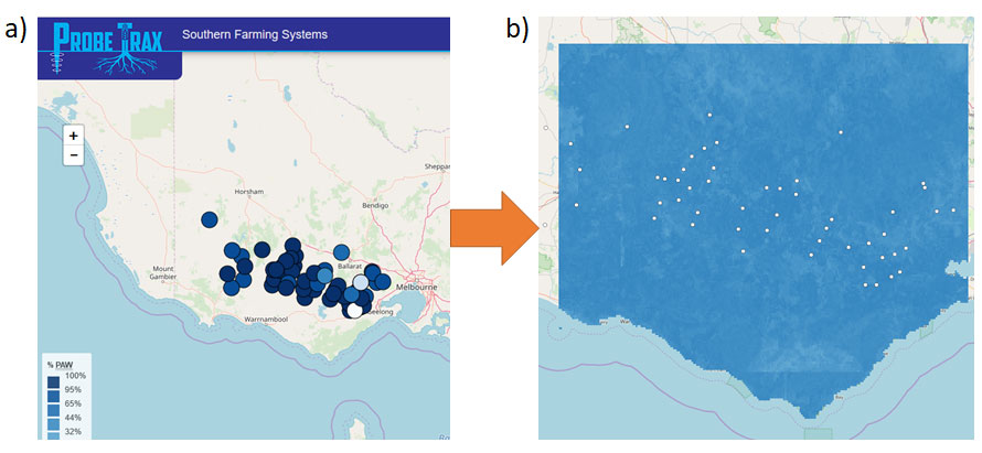
“We now have machine learning on services set up over the soil moisture probes. This is producing interpolated maps, that is predictions of soil moisture between the locations of probes”
“Providing the data as a service makes it much easier for researchers to provide these maps - the models can run automatically and be updated overnight”
“These maps will provide added value to the data provider (Southern Farming Systems) through making their data more FAIR through AgReFed”
The data is now more easily discoverable via the internet, and accessible directly to users via an authentication system. This means the soil probe data is more likely to be re-used whilst protecting the rights of the data owners.
The future
Through delivery in standard format, Southern Farming Systems soil moisture probe data now has the potential to inform more robust predictive models at the local, regional, and National scale. It is now also more reusable for the development of on-ground decision making tooling.

Soil moisture observations at specific soil probe locations (a) is now being used for dynamic modelling to predict soil moisture levels between probe locations (b).


